Within the framework of project planning and environmental assessment, every component of analysis serves a crucial function. Yet, amidst the complexity of proposed action alternatives, resource area analyses, and more, one basic component stands out above the rest: the project location. Without a defined geographical context, all other efforts become aimless. Geographic Information Systems (GIS) is the starting point for understanding a project’s location and, thus, the project in its entirety. How GIS is used to gather and interpret data can make or break a project. Many people know about GIS, but it is a constantly evolving technology. Here are some of the latest developments to make the most of GIS in the field.
- How Can GIS Help with Project Analysis?
GIS can be leveraged to answer the two central questions every project presents:
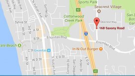
- “Where?” Where is the project located in the world? Where is it located in relation to other resources?
- “What?” What is already there? In what ways will the proposed action alter the current environment? What impacts will the project have?
A GIS professional can answer these and many other subsequent questions without ever leaving their desk. However, a field visit is often the best way to gather real-time information about a project site. In this case, the question shifts from, “What’s out there?” to, “How do we get this information from the field to the screen?” When it comes to GIS, the methods to answer this question are seemingly infinite!
- What Are the Key Methods of Data Collection?
Paper maps are still a fool-proof tool for field visits. When cell service cuts out or the device battery dies, the paper map remains. Paper maps serve not only as a backup to digital maps, they are also great for creating a plan for the visit and navigating the site upon arrival. Field workers may use paper maps to take notes, identify key areas, and record observations, supplementing mobile solutions.
Mobile devices have transformed the data-gathering process for field workers. With an endless array of mapping services and apps – not to mention a built-in camera – no field visit is complete without a phone or tablet.
- How Has Scout Used Mobile GIS Capabilities in the Field?
While it would be impossible to list all the available mobile applications, the list below includes a few of Scout’s favorite ways to gather data in the field.
- Photos: Smartphones automatically use GPS to record the location of every photo taken. Make sure the location feature is enabled, and then snap away! These can be sent to the GIS professional to integrate the coordinates into their analysis in the office.
Scout example: Recording the location of specific features in a project area.
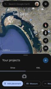
- Google Earth and ArcGIS Earth: These apps can be downloaded to any mobile device. They allow the user to gather new point, line, or polygon (i.e., any closed shape) data for free. These files can then be packaged and sent to the GIS professional for further analysis.
Scout example: Collecting and verifying facility details for Facility Condition Assessments.
- Web Maps: ArcGIS Web maps are interactive maps that can be opened on a computer or mobile device via a web link. They allow the user to explore a project location by clicking on features, turning layers on and off, zooming in and out, and seeing where they are relative to various features. Web maps do not allow users to edit features, so they are most useful for site visit planning and navigation.
Scout example: Deploying a plan for Facility Condition Assessments with a large team.
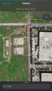
- ArcGIS QuickCapture: This is a form-based app created by Esri that requires a login. It is useful for collecting a quick snapshot of field findings. A GIS professional designs the form prior to the visit to allow the user to create points, lines, or polygons; attach photos; and add any additional information needed (i.e., item/location name, description, photo details). The data collected can be synced directly with a current project for a seamless file transfer.
Scout example: Recording unmapped trails in a project area.
- ArcGIS Field Maps: This is a map-based app created by Esri that is useful for gathering new data while showing the user their location on a map. Like QuickCapture, it can be programmed to create points, lines, or polygons, attach photos, and add any additional information needed (i.e., item/location name, description, photo details). However, unlike QuickCapture, Field Maps also gives the user the ability to see where they are on a map and sketch new features directly onto it. The data collected can be synced directly with a current project for a seamless file transfer.
Scout example: Gathering visual and cultural resource information in an area of potential effect.
These, and countless other mobile solutions, are essential to simplify data collection, improve accuracy, and streamline data transfers and analysis in the office.
Conclusion
GIS is crucial to addressing the “what” and “where” of any project. While GIS professionals may offer insights remotely, field visits remain invaluable for real-time data collection. Transitioning from fieldwork to digital analysis underscores the importance of seamless integration between on-site observation and GIS technology. From traditional paper maps to specialized apps like Google Earth and QuickCapture, GIS solutions facilitate efficient data gathering and subsequent analysis, enhancing project decision-making processes.
My colleagues and I at Scout can be counted on to provide high-quality GIS services to lead the way to your objective! If you have questions or need any support, contact us today at: hello@scoutenv.com.


